
Topographic Surveys and Why Builders Depend on Elevation Data
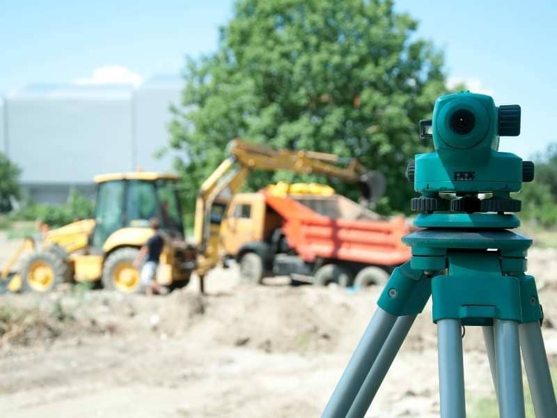
A construction plan can look perfect on paper. But paper does not show a hidden slope, a low spot that fills with water, or a change in ground height that could throw off a foundation. That is why a topographic survey matters. Builders use one before they dig the first shovel of dirt.
A topographic survey maps the true shape of a property. It shows the elevations, slopes, and natural features of the land. Without this information, engineers and builders are just guessing how the land will act. Getting this right at the start saves time, money, and extra work later.
A topographic survey records many height points across a piece of land. These points get placed on a map, often using lines called contour lines. These lines show where the ground goes up or down. This gives builders a true picture of the land before they make any design choices.
Existing Elevations Establish the Starting Point for Construction
Every construction project needs a starting point. That starting point is the current height of the land. Without correct height information, engineers cannot make a grading plan that will actually work.
A topographic survey records these heights across the whole property. This includes the high spots, the low spots, and everything in between. Engineers use this information to plan foundations, roads, and drainage systems based on the real land, not guesses.
- Confirmed ground heights at key spots on the site
- Natural high and low areas that affect water flow
- A solid starting point for every choice made after this
A mix of old neighborhoods and new building projects. This means every lot can look very different from the next. A topographic survey removes the guesswork, no matter how a property has changed over time.
Grade Differences Shape Excavation and Fill Requirements
Once the current land height is known, engineers compare it to the height needed for the finished project. The difference between these two numbers tells them how much dirt must be removed, called cut, or added, called fill.
Getting this number right matters for both cost and time. If a builder guesses too low, it can lead to delays and extra costs once machines are already working. If a builder guesses too high, the bid for the job can end up too expensive.
A topographic survey gives engineers the correct starting heights they need. This helps them figure out cut and fill amounts with confidence. It also helps contractors give better price quotes and helps property owners avoid surprise costs during construction.
Elevation Data Supports Foundation and Floor Planning
Foundation design depends a lot on correct height information. How deep a foundation should be, how high the finished floor should sit, and how the ground slopes around a building all come from the height data found in a topographic survey.
This matters even more in places that flood easily or get heavy rain. This includes parts of the area near rivers, wetlands, and low ground. Builders often must build the finished floor above a certain flood height. That rule depends on having correct site information from the very start.
Check with your engineer and your local building office to see if your project has rules about flood zones or drainage. These rules can change depending on the city or town and where the site sits.
Drainage Planning Depends on Reliable Site Elevations
Water always moves toward the easiest path, and that path depends on height. A topographic survey shows exactly how water moves across a site right now. This information is needed to build a drainage plan that actually works.
Bad drainage planning causes some of the most common and expensive problems in construction. Water pooling near a foundation, water running onto a neighbor’s yard, or a drainage system that does not match the real land can all trace back to missing or wrong height data.
Engineers use topographic survey data to plan ditches, drains, and slopes that move water away from buildings and into the right drainage areas. This step protects the building and lowers the chance of a fight with a neighbor over water problems.
Updated Elevations Help Verify Construction Progress
Topographic surveys are helpful even after construction starts. A new height survey during a project can confirm that the grading and digging match the approved plan.
This is very useful on bigger job sites or projects built in stages, where small mistakes can add up if no one notices them. A follow-up topographic survey checks the current land against the planned heights. This shows any problems before they turn into expensive ones.
Ask your surveyor if a progress check makes sense for your project. This is especially true if the grading work is large or the site has had drainage problems before.
Frequently Asked Questions
What is the difference between a topographic survey and a boundary survey?
A boundary survey shows the legal lines of a property. A topographic survey maps the physical features and heights of the land, including slopes, buildings, and natural features. Many projects need both types.
How is elevation data used in a topographic survey?
Height data forms the base for grading plans, drainage design, and foundation planning. Engineers compare the current land height to the planned height to figure out cut and fill amounts and build a plan that works.
Do I need a topographic survey for a small home project?
This can depend on the size of the project, the condition of the lot, and what your local building office requires. Ask your surveyor and engineer if your specific project needs one.